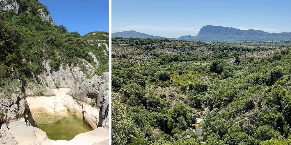
Tucked away inland from Montpellier and Saint-Guilhem-le-Désert lies a magical natural site: the Ravin des Arcs. A short walk takes you here, at only a 45-minute drive from the city centre, and just a stone’s throw from the village of Saint-Martin-de-Londres. In this change of scenery, erosion has carved a narrow 10-kilometre canyon in the Lamalou riverbed. It features high cliffs, potholes and the highlight: a superb naturally shaped arch. The perfect environment for some exercise!
Natural Concert
Driving to the start of the hike at the Masclac bridge just outside Saint-Martin-de-Londres was already beautiful. The road took Chéri and me through a remote landscape of garrigue, the typical Southern French scrubland, dotted with charming villages. Arriving at the trailhead, a well-designed sign listed two options. The first was a 1.5 hours back-and-forth walk of 4 kilometres at an easy level, in case there was water in the riverbed. When the river is dry, you can opt for the moderate circular walk of the same length in the same amount of time. Since the family and I normally walk longer distances, Chéri and I both thought it would be a piece of cake. The first part was easy indeed, following a gently ascending path along the Lamalou River. Accompanied by a natural concert of cheerful croaking frogs and tinkling cowbells, we reached the first panoramic view.
Impressive Arc
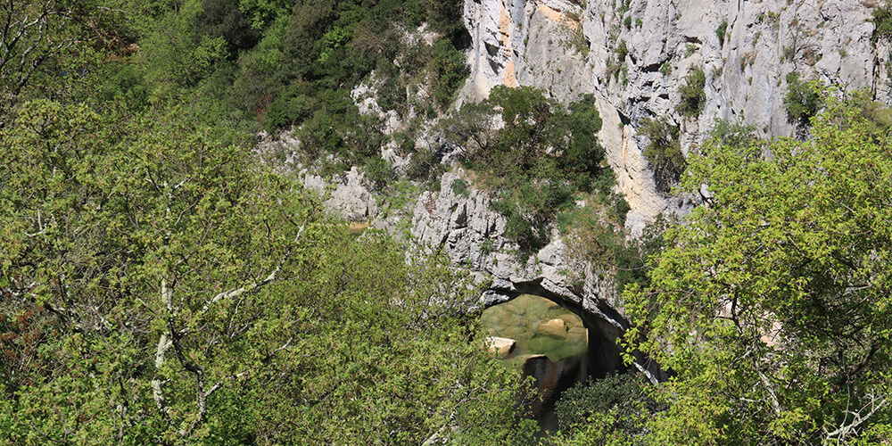
To get to the river, there was some climbing and descending, partly through a forest. With it being the first warm day of the year, we could feel the sweat dripping down our backs. The last bit down to the riverbed was a tricky descent, known as a ‘descente délicate’ in French. Well, there wasn’t much delicacy involved when going downhill, mainly due to the many gravel parts and loose stones. However, it was all worth it, as once we reached the riverbed, we were immediately awed by the impressive arch towering above us. During our last hike here, the Lamalou River was in full flow. Therefore, signs clearly indicated that we couldn’t cross the river and had to return the same way. Especially after the first rainfall of the year, the river can turn into a wild torrent, so be careful!

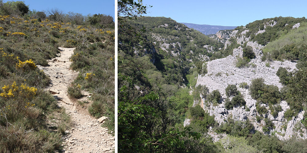
Rock Hopping
A couple of years ago, we hiked to the Ravin des Arcs during the high season and were able to cross the riverbed since most of the water had already gone by then. Although we were slightly puzzled about how to continue on our way, the signs really led us into the riverbed. Therefore, we had to step up our efforts by hopping from rock to rock. Once across, we took a moment to catch our breath and enjoy the surroundings before the workout continued… The ascent was quite challenging over a short but steep trail. But we made it, and as the path levelled out, it rewarded us with an amazing view of the Pic Saint-Loup. In the end, we completed the not-so-moderate round trip in 1.5 hours, just as indicated by the sign at the trailhead. Sweaty, tired, but satisfied. Who needs a gym when you can hike?